Our Bushfires and Wine Regions Map of Southeastern Australia is published as a public service. The bushfires data were updated on 24. January, 2020.
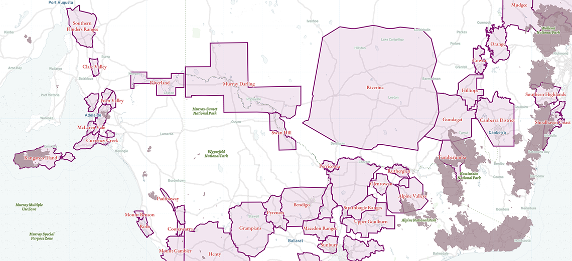
Bushfire data are compiled by the EMSINA Group and Geoscience Australia and sourced from
The map does not contain Western Australian, Northern Territory, or Queensland Parks Bushfire Boundaries.
This map is not updated on a daily basis and should not be used for emergency management purposes. No intellectual property claims are made for the map data and no liability is accepted.
Wine Regions are from Wine Australia.