Top View of 3d Map of Beechworth
The geography of the wine region comes alive in this format. The ability to see and touch the landforms makes it easy to understand how wind, rain, and temperatures affect the grapes.
The full-colour terrain model was printed using additive manufacturing technology, also known as rapid prototyping or 3D printing. The high resolution 3d modeling now possible from these machines makes for a stunning and uniquely informative map.
The model measures 240mm x 365mm and would look great in cellar doors and visitor information centres. Other applications include museum exhibits or any situation where mapping information benefits from being presented on a 3d map of the land.
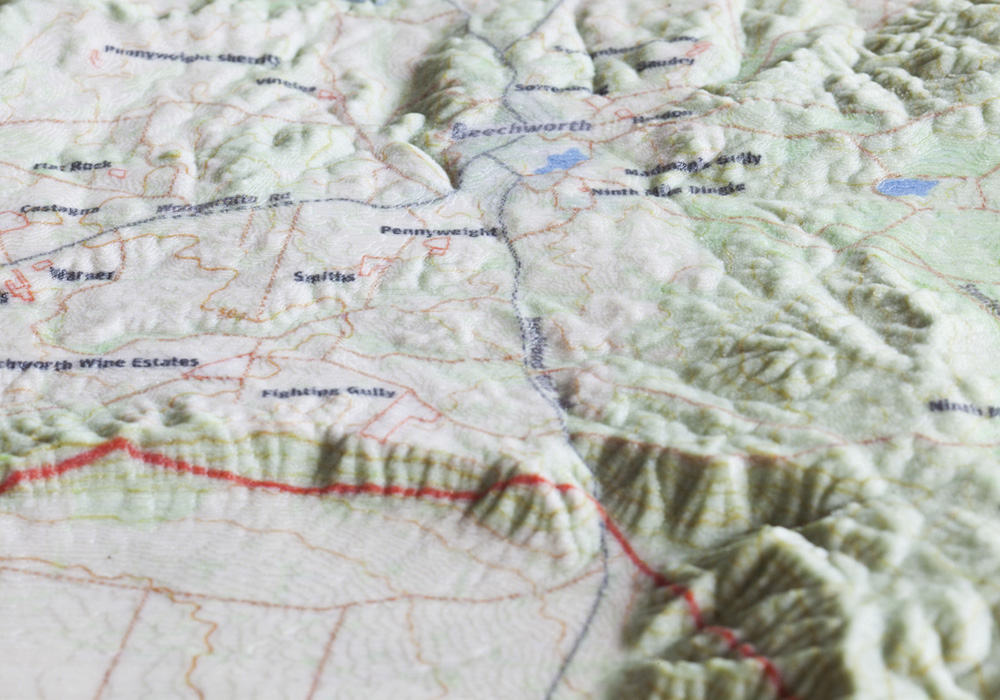
High-resolution printing
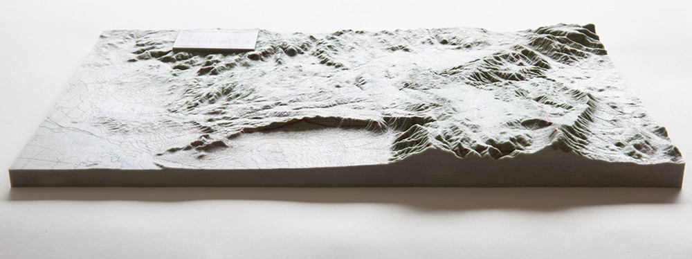
View of 3d Map from front
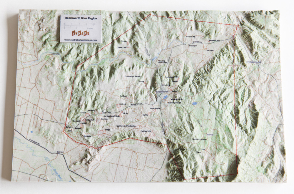
Top view of 3d Map