The gorgeous, large-format National Geographic Atlas of the World, 11th Edition, has been released. vW Maps was asked to contribute a collection of maps and information graphics for a spread on human migration, and we are thrilled with the result.
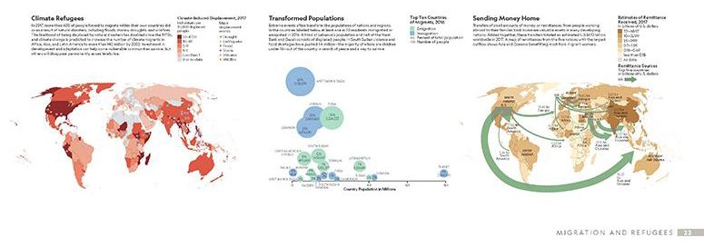
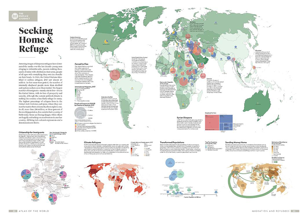
Of course war and ethnic conflict are major causes of cross-border migration, as indicated by the Syrian Diaspora graphic and flow arrows emanating from Myanmar, but the extent of internal displacement in Colombia, for example, surprised us. A map of wages sent home from workers living abroad tells of wage and job opportunity inequalities between nations. A bubble graph compares the number of immigrants and emigrants by country on the basis of proportion of the population while a map of Europe shows which immigrants are granted citizenship and where. And a map of global climate events reveals how weather events can affect the rich and poor alike.
A clever design feature of the atlas is that the main maps of these thematic plates use one of two map bases, and at the same scale. This allows the reader to flip between pages to reach a better understanding of how the physical, economic, climatic, and social dimensions relate.
As gratifying as it is to see our work so beautifully reproduced, the long-lasting satisfaction lies in the hope that our work will inspire and motivate the thought leaders, policy makers, and inventors of the future.
Refugee Spread