Accurate • Beautiful • Convincing
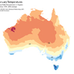
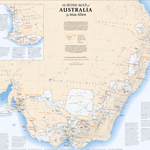
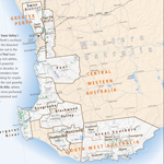
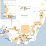
Over thirty of our maps illustrate this award-winning book on Australia, its wine regions, and its winemakers
Christie’s World Encyclopedia of Champagne & Sparkling Wine is by Tom Stevenson and Essi Avellan with maps by vW Maps
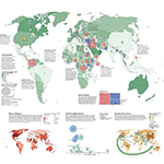
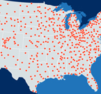
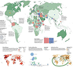
We contributed maps and information graphics to the new edition of the National Geographic Atlas of the World. The spread on human migration explores various forces that cause people to flee hardship and crisis.
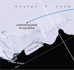
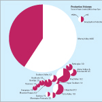
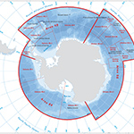
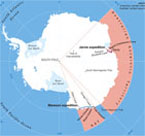
A map of Antarctica focuses on the water in which the organisation’s interests lie.
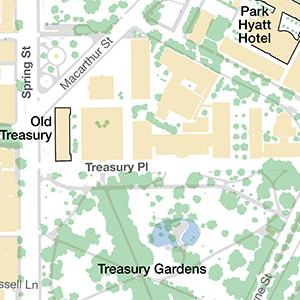
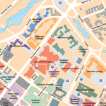
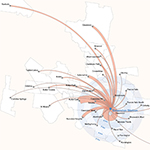
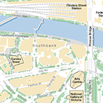
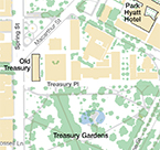
A delegation from overseas needed a simple map of the city and they needed it NOW!
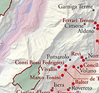
vW Maps is proud to have made many maps for Christie’s Encyclopedia of Champagne and Sparkling Wine.
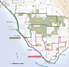
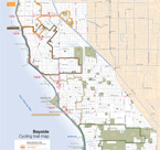
The Bayside Cycling trail map shows the on-road and off-road bicycle paths plus amenities of interest to cyclists including bike shops.
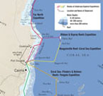
This series of maps for a richly-illustrated book on a pioneering eco-tourism company is designed to stand up to the stunning underwater photography that was the core of this book.
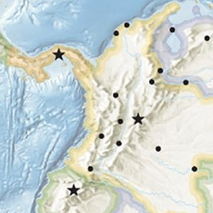
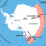
For the recreation of Douglas Mawson’s epic journey across the ice of Antarctica, author Tim Jarvis was accompanied by a film crew. The book of his journey, therefore, is lavishly illustrated with vivid photographs of the colourful visitors on the white snow and ice.
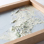
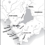
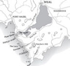
vW Maps’ first published map of a fictional place, the map of Weal and its surrounding Southern District is the depiction of a place clearly thought out in great detail by an author for her first novel.
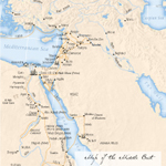
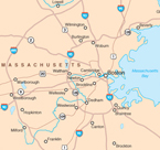
This map, originally designed for a brochure, has appeared in many magazines, theses, reports, and websites.
The commercial real estate sector requires maps that function as eye candy in addition to being geographically precise.
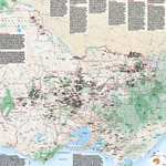
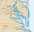
An historic look evokes the long history of beer brewing along the eastern seaboard of the US.