Accurate • Beautiful • Convincing
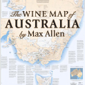
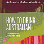
Over thirty of our maps illustrate this award-winning book on Australia, its wine regions, and its winemakers
vW Maps recently designed a vacuum-formed, or thermo-printed, raised relief map of the wine regions of British Columbia, Canada.
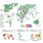
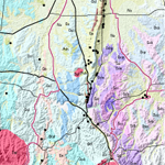
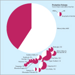
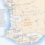
For the Climate Council, Australia’s leading climate change communications organisation, vW Maps has mapped the areas that governments have provided or are considering providing to gas companies to look for and produce gas.
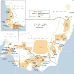
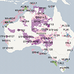
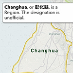
The World Wine Regions atlas maps all the wine regions in which grapes are grown and wine is made, both the official as well as the emerging, unofficial regions.
World Wine Regions is an interactive atlas dedicated to the wine regions of the world, from the storied appellations of the Old World to the newly minted regions still building their reputations.
vW Maps has published World Wine Regions, an atlas of the world’s 1800+ wine regions. Rather than showing the whole world, clients can choose a customized map of just their region instead.
Christie’s World Encyclopedia of Champagne & Sparkling Wine is by Tom Stevenson and Essi Avellan with maps by vW Maps
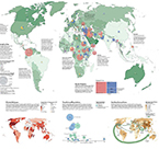
We contributed maps and information graphics to the new edition of the National Geographic Atlas of the World. The spread on human migration explores various forces that cause people to flee hardship and crisis.
National Geographic needed new interactive maps for a website and an app.
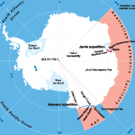
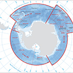
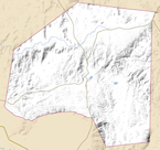
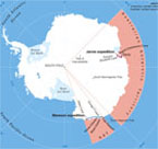
A map of Antarctica focuses on the water in which the organisation’s interests lie.
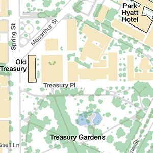
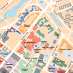
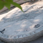
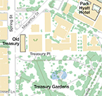
A delegation from overseas needed a simple map of the city and they needed it NOW!
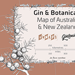
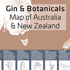
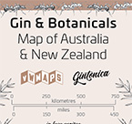
The Gin & Botanicals Map of Australia & New Zealand has 101 gin distillers and producers mapped and ten indigenous botanicals described in words, maps, and illustrations.
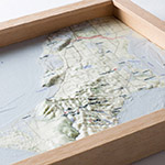
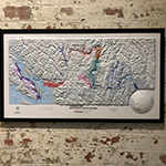
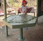
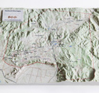
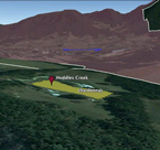
A premium Mornington Peninsula wine producer commissioned a terrain model for use at their restaurant to illustrate the factors that contribute to a vineyard’s terroir.
vW Maps is proud to have made many maps for Christie’s Encyclopedia of Champagne and Sparkling Wine.
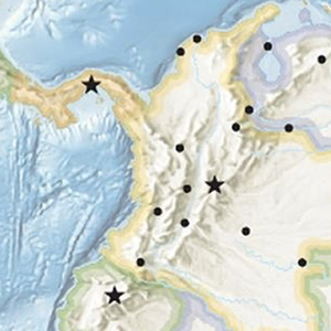
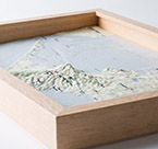
The dramatic landscape of a national park is a fascinating subject for a model printed with GIS-technology and meticulously painted by hand.
An animated map movie of the vineyards of the Beechworth Vignerons. “It’s brilliant”, said Tony Keys, TKR, 15 November 2012.
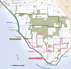
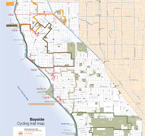
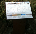
The Bayside Cycling trail map shows the on-road and off-road bicycle paths plus amenities of interest to cyclists including bike shops.
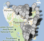
The Vines of Tasmania is a browser-based application that allows grape growers to update the status of their grapes so that fuel-reduction burns can be avoided in the vicinity of susceptible grapes.
Topographically-accurate 3d models bring the geography of a region to life.
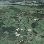
A fly-through of one of Victoria’s finest wine regions reveals the geography behind a leading Australian winemaker.
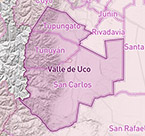
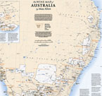
This map charts the diverse combinations of climate, country and culture that make each of Australia’s wines taste unique.
This series of maps for a richly-illustrated book on a pioneering eco-tourism company is designed to stand up to the stunning underwater photography that was the core of this book.
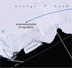
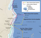
For the recreation of Douglas Mawson’s epic journey across the ice of Antarctica, author Tim Jarvis was accompanied by a film crew. The book of his journey, therefore, is lavishly illustrated with vivid photographs of the colourful visitors on the white snow and ice.
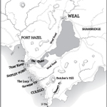
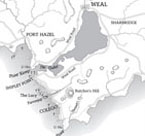
vW Maps’ first published map of a fictional place, the map of Weal and its surrounding Southern District is the depiction of a place clearly thought out in great detail by an author for her first novel.
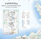
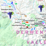
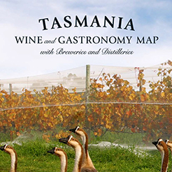
The most up-to-date touring and tasting guide to Tasmania’s vineyards, wineries, cellar doors, breweries, distilleries and gastronomic bounty, authored by the island’s leading food and wine critic, Graeme Phillips.
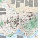
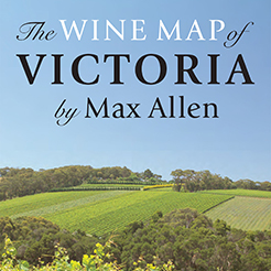
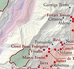
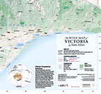
With text by leading Australian wine writer Max Allen, this double-sided map is the most comprehensive listing of Victoria’s 900 cellar doors, wineries and distinguished vineyards ever published.
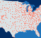
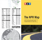
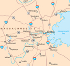
The NPR Map from vW Maps is the perfect companion for road trips across the USA. Use it locate the stations along your route that carry programming from NPR.
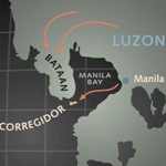
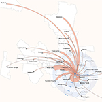
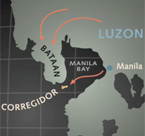
The American Experience is one of the longest-running and most respected documentary series produced by public television in the United States. The multi-part biography of General Douglas MacArthur features numerous maps by vW Maps.
A multimedia CD-ROM contained some of the first animated maps in a consumer product. The look and feel of these maps presented an exciting design challenge.
How a medium not often used for cartography presented a tremendous design opportunity
A map that appears for a few seconds in an interactive CD-ROM has different design requirements to a printed map.
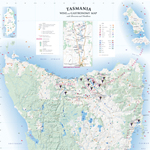
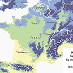
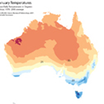
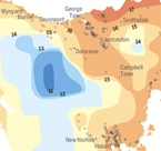
Overlaying vineyard locations on a map of Bureau of Meteorology climate data provides insights into the qualities of the wines. A map makes the case for Tasmania’s standing on the world stage by revealing similarities with the climates of famous wine regions in Europe, North and South America and New Zealand.
This map, originally designed for a brochure, has appeared in many magazines, theses, reports, and websites.
A map helps hikers find their location as they explore a coastal trail.
The commercial real estate sector requires maps that function as eye candy in addition to being geographically precise.
An historic look evokes the long history of beer brewing along the eastern seaboard of the US.